First, let’s get the terminology right. What most people seem to refer to as Pittwater is only a fraction of some expansive and breathtaking waterways, which also include the Hawkesbury River and Brisbane Waters. These three arms lead into Broken Bay which comprises the broad entrance from the Tasman Sea, marked by Box Head to the north and Barrenjoey Heads to the south.
Broken Bay
Geographically, Broken Bay is a tide-dominated, drowned valley which flows openly into the Tasman Sea. Some historical quotes state James Cook recording “broken land” north of Port Jackson just before sunset on May 7th, 1770 and naming it Broken Bay. Other sources say that this large, often swelly inlet of the Pacific Ocean was passed unnoticed at night. Whatever the case, Governor Phillip was the first white settler to examine the present-day Broken Bay in a longboat from the Sirius, on March 2nd, 1788.
Sailing up the approximately 16 nautical miles from Sydney Heads, one of the first sights you glimpse of Broken Bay is Lion island: an eight hectare nature reserve only accessible to a colony of fairy penguins. From some viewpoints it resembles a Sphinx, thus the name.
North of it you can see Pearl Beach’s lush, but swelly shores and Umina’s shallow sandbanks, which could easily trap the unfamiliar sailor at night.
To the north, Broken Bay is framed by the beautiful Bouddi National Park, including its only deep anchorage, Iron Ladder Beach, right between Box Head and Little Box Head. We tucked in here a few times for some snorkelling and lunch while waiting for the high tide to go back through the Ettalong Channel. However, safe and comfortable overnighting here would need calmer conditions than what we have ever experienced.
To the south, Broken Bay is framed by the prominent Barrenjoey Lighthouse, 91 metres above water levels. Sydney’s most northern point also marks the entrance to Pittwater.
Pittwater
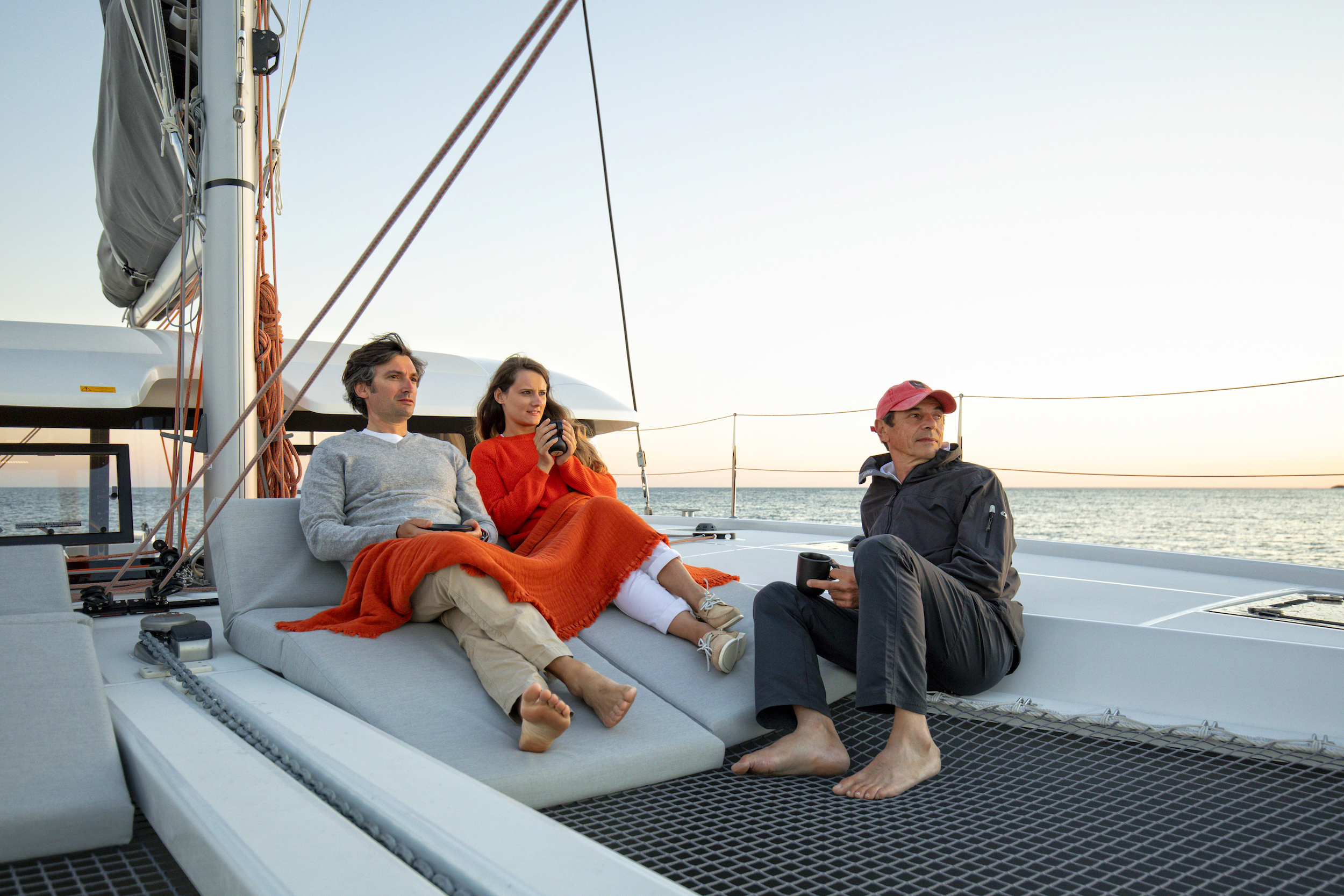
“They say when the wild beauty of Pittwater gets hold of your heart, it never lets go and you are seduced forever,” writes Susan Duncan in ‘A life on Pittwater’. During our first few months living on the Central Coast, every weekend we ended up sailing to the Basin, Pittwater’s most popular bay. Great expanses of flat, grassy park land; gas BBQs; showers and toilets in Ku-ring-gai Chase National Park’s only designated camping ground. Long stretches of white, sandy beach; a netted swimming enclosure; crystal clear lagoon and walking tracks with spectacular views and access to one of NSW’s best examples of Aboriginal rock engravings make this bay close to perfect. We have had many visitors join us here by ferry which regularly connects to Palm Beach.
After Captain Cook’s brief mention, it was during Governor Philip’s 1788 excursion, six weeks after settling in Sydney Harbour, that he allegedly declared Pittwater “the finest piece of water I ever saw.” He named it after William Pitt, Britain’s youngest Prime Minister aged 24 when he took office in 1783.
Coasters Retreat
There is great protection for all but south easterlies and strong south westerlies. Amongst the 100 club moorings in winter there are always plenty available. But here comes the ‘but’: in summer it is one crammed armada of yachts as many sailing visitors understand this is just the tip of the iceberg of numerous stunning bays in the area. Before we take you further south into Pittwater, a bit of history.
The Basin is still sometimes referred to as Coasters Retreat as this is where ‘coasters’, ships used to carry cargo along the coast from port to port, would seek refuge when bad weather brew up. Long before that, the Ku-ring-gai people inhabited this area for a long time, as highlighted by exceptional heritage sites, including the petroglyphs of hunters, kangaroos, fishing and Wallabies and the Red Hands Cave.
Up to this very day, exploring the western side of Pittwater is still like stepping back in time. In this ancient landscape, people commute by boat, wallabies grace on lawns and goannas sneak up to steal food from your picnic blanket.
If it had not been for the foresight of an Englishman with the improbable name of Frederick Eceleston du Faur, the whole area would have succumbed to urban development. Du Faur was a keen conservationist long before it became fashionable. He succeeded in pressuring the state government to set aside 35,300 acres from Hornsby to Pittwater, Cowan Creek and Broken Bay. Walking tracks, wharves and even some cottages were built to attract holiday makers. Traces of all can still be found today.
Towlers Bay
Between Towlers Bay and Coasters Retreat there is a quaint, not commonly visited beach. There are no moorings, but good anchoring for up to five boats on a sandy bottom. Great in winter months, Portuguese Beach offers protection from westerlies and sunshine the minute the hot sphere emerges on the horizon.
The next bay south is supposedly Kay Cottee’s favourite, enough to grab my attention. Our first approach was in the dark but, in mid-winter, most of the 25 club moorings were easily available.
Most of the Towlers Bay is relatively deep but it drops off suddenly towards the beach, which greeted us welcomingly in the morning: sparkling sand, plenty of rock platforms, water trees with improvised rope-swings and a lagoon and grass lands to keep the kids’ entertained for hours.
After lunch on a friend’s boat, we went to explore the stone ruins of the old jetty in the north-east section of the bay. Our inflatable dinghy only just saved itself from death on the oysters. Ashore, we set off to explore the few leftover ruins of the old ranger’s cottage. In the olden days, he would walk from here to the Basin every day. His adventurous track is still around and I can not help but wonder whether back in the days he would have already seen the croissant or beer stop potential at the spots along the track with the most stunning views.
Beyond Morning Bay
The south western arm of this haven, Morning Bay, has plenty of room for anchoring too but stay equally alert of the depth as it shallows rapidly towards the head.
A small creek enters here. Exploring it on your dinghy at high tide, you might be surprised how far you can venture into the dense rainforest. Coming from the north, this is Pittwater’s last protected anchorages not filled with permanently moored vessels.
As we prefer wild and rugged to busy, built-up and anchoring-restricted, we have not found a reason yet to sail to any other of the hand-spread bays reaching out from Scotland Island: McCarrs Creek, Elvina, Lovett and Little Lovett. Having said that, there are a few temptations, including the 20 minute bushwalk leading to the Elvina Bay waterfall past some early settlers’ graves; a hike at Flagstaff, behind Lovett Bay ferry wharf, with a creek, tiny waterfall, vast Pacific Ocean views and rocky outcrops at the summit; the 715 people community on mostly protected Scotland Island; and even Church Point’s bottle shop, general store and its banging, clanging, rocking and rolling melee of dinghies reflecting the more remote way of life dinghy-commuting residents have chosen.
Stories of falling overboard on your way home are so common, that unless you sink with your life’s savings, your wedding photo albums and your mother-in-law, they rarely even get told.
The whole east shore of Pittwater is also fitted with permanent moorings, houses, some beaches and the occasional ferry wharfs. As a basic rule here, consider that if the water was deep enough, there would be permanent moorings.
Some lunch stops
Before leaving Pittwater you will notice four more smaller beaches to the north west. None provides great protection.
Just north of the Basin, Mackerel beach is a nice lunch spot with a considerable variety of marine life inviting for a snorkel. The north end shoals rapidly.
Little Mackerel Beach is the home of the historic and picturesque labour council resort, formerly reserved to trade union members.
Resolute and Little Resolute Beach are both isolated little lunch time spots at best due to their openness to swell. If you can pick them on a westerly or calm day, they are, however, one of the crystal-clearest spots to swim before you leave Pittwater. There is also a fantastic walking track directly to West Head lookout for spectacular views.
Overall, Pittwater has ample 4G mobile coverage, plus convenient marinas, fuel, water and pump-out facilities, such as at the Royal Motor Yacht Club where members can also enjoy the heated pool, a 100 ton slipway and a variety of marine trade services on site.
Marginally further south, Royal Prince Alfred Yacht Club marina offers visitor berths and water for members and guests. Both places have enjoyable restaurants and generally around Pittwater’s civilised side, a café or pub is never far. This drastically changes when you head around West Heads into the more secluded parts of the mighty Hawkesbury River. Rugged, untamed bush await amongst quiet isolation one disrupted by lyrebirds singing their hearts out, inspired by sugar gliders, possums, wallabies, owls and bandicoots.
The Hawkesbury
The Hawkesbury River and its associated main tributary the Nepean River, virtually encircle the metropolitan region of Sydney, travelling for almost 120 kilometres to its mouth at Broken Bay, about 15 kilometres from the Tasman Sea. The land adjacent to the almost 22,000 square kilometres of water was occupied by the Darkinjung, Darug, Eora and Ku-ring-gai people who used the drowned valley estuary as a source of food and a place for trade.
The first two beaches to the south are affected by Tasman Sea swell, but beautiful day-time stops. The large sandy beach at Flint and Steel invites a picnic lunch, or the steep 40 minutes track to West Head, where daring fitness enthusiasts are rewarded with 360 degree views.
Hungry Beach, a little further west, features dramatic cliffs. In numerous caves middens of discarded shellfish mounds tell stories of a time when the indigenous people took shelter here.
Just west, Little Pittwater is a rugged bay with difficult access to the shore due to a rocky shoreline. However, it is more protected for a potential overnight stay. A great spot to watch the world go by, its size limits it to more or less two boats. In all three beaches, a bottom of mud and sand allows good anchoring.
Patonga and Little Patonga Beach
While you pass the above-mentioned, to your north you will notice the sleepy little fishing village of Patonga. The one weekend in months where there was absolutely no swell at a half-moon cycle, we took our chance to anchor here.
Usually this large beachy bay is prone to sea swell and strong tidal movements. We knew that we had to stay out of the ferries’ way and off the north east, which shoals to a constant shallow depth from a surprisingly long way out.
But one thing we did not know that day was the renowned fish and chip shop was closed for renovations. With no other café, nor store around, it was a close call to a pizza delivery from Umina. In the end, we scrapped together the few packs of Asian noodles that we had left in the bilge and made a beach picnic of it.
The swarm of pelicans and feel of a place that time forgot, made it an enjoyable memory, despite all.
Just west lies Little Patonga, a slightly more protected bay, especially when tucked up under the eastern headland. There is a NSW Sport and Recreation camp on the ground, which can be somewhat protective of the beach. It gets busy here with fickle winds, strong tides, ferry traffic and an elaborate buoyage system outside of which it gets very shallow.
Your main reason to explore is most likely the Hawkesbury River Marina at Brooklyn with cafes and a pub within arm’s reach. It is also a convenient spot for tacking on fuel and picking up guests.
America’s and Refuge Bay
Jumping back south, most people chuck a left once the large, popular and protected Refuge and America’s Bay appear on their port side. Always-present crowds are all there is not to like about these two connected bays, scattered with close to a hundred private, club and courtesy moorings.
Refuge Bay features a small beach with a fresh waterfall, which tops any luxury outdoor shower. Like all surrounding bays, they can only be accessed via boat or serious bush-hiking; paradise-factor integral.
Less busy and just a few minutes further, still on your port side, you will notice Hallett and Little Hallett’s Beach. The former has a handful of public moorings and a nice, medium-sized beach.
In all but strong NE it gives reasonable protection. In fact, most nights we spent here were so still that the main noise interrupting the night was the mooring buoy banging against our hull. Little Hallett has a smaller beach and a waterfall.
Right opposite you will find three little bays, with a few scattered public moorings each. With a rainforest rock backdrop towards the west, they can get shady quite early in the afternoon but are the spot to be for a sunny breakfast and early morning swim.
Jerusalem Bay and surroundings
Sailing on with the sun you will see another handful of small, secluded beaches on either side, most offering a few courtesy moorings. If they are busy, there is no more space for anchoring.
To the north, you start heading into Jerusalem Bay, unless you pick up a mooring at the tiny, protected inlet of Little Jerusalem Bay. One fine winter day we picked up the last of the three moorings in Jerusalem’s well-protected Pinto Bay, which ends in a marshland surrounded by pristine, quiet bushland, like most places
in these plentiful, lush, sheltered creeks.
In summer it is close to impossible to get a mooring here as most are permanently busy with not one, but up to six motorboats rafting up. Even on days featuring several metres of swell near the heads, you will barely see a ripple here. Older kids and fun-loving adults swing of a rope hung off a tree, younger kids explore the safe bay in dinghies and kayaks.
If you were to get stuck in this inlet’s safety and serenity until you run out of provisions, Cottage Point is just a few bays away.
Cottage Point
One of our most beautiful sailing weekends had us land in Refuge Bay after a beam-wind sunset sail from Brisbane Waters. Our still young kids did not have it in them to sail any further.
After a restful and relaxing night, we spent the next morning exploring deep into the creek and felt like in the Jungle Book itself: caves, waterholes, lyrebirds, pristine forests and skinny dips included.
When hunger started tickling our tummies, no-one felt like cooking, so we motor-sailed to Cottage Point Kiosk. Had we gotten there a minute after our 1400 arrival, the one café courtesy mooring would have been gone.
Having said that, anchoring just off the permanent mooring field would not have been the end of the world either.
During our long and lazy BYO lunch at the kiosk we caught snippets of a vast array of languages, faces and interesting conversations around us: from China, to Europe to Brazilian visitors who had hiked here for a day visit.
Conveniently located opposite Cottage Point, Looking Glass Bay offers protected deepwater anchoring space for up to four boats within arm’s reach to the amenities of Cottage Point, including water, fuel and pump-out facilities. In addition to the kiosk, there is also the Cottage Point Inn where the rich and wanna-bes fly their friends in by sea-airplane to join them
for extravagant lunches or dinner.
The white tablecloth restaurant also has a couple of pontoon spots available for customers. These are great if you do not mind being part of the other guests’ visual entertainment, amongst the busy stream of planes, ferries and private water-taxies.
The creeks
After our Cottage Point lunch, we landed at dusk in Waratah Bay in Cowan’s Creek. There are between one and four moorings in each of the small, secluded bays along the rocky shoreline. They tend to be empty most of the time.
As we caught the last hour of sunshine, the kids went out exploring in the dinghy while I enjoyed my latest book, ‘Surviving the savage seas’, in the soothing quiet of what seemed like a cove at the end of the world.
Between Arwen, Smiths and Cowan Creek, there are too many bays to count. To go into each of them would take up most of this magazine, plus take away the fun of discovering some secrets yourself. In a nutshell: peaceful, beautiful glassy bays surrounded by bush describes the general feel.
A few moorings are sprinkled in most of them. The average depth is at least ten metres and sandy beaches are rare, yet other little gems are spread all over the national park and coastline. Just to set you off on a little treasure hunt, here is some key attractions for some of our favourite creek spots, from east to west.
Castle Lagoon in Cowan’s Creek features a hidden waterfall at the north eastern side of the bay.
At the head of Yeoman’s Bay is a big, shallow sandy area that leads into a long meandering creek easily navigable in your dinghy. If you are into a bit of a bush bash you can follow this creek line up to a beautiful cascading waterfall and swimming hole.
The floating dock at Akuna Bay at the head of Coal and Candle Creek has water and pump-out facilities for marina clients and berths for restaurant visitors.
Smith’s Creek’s seeming remoteness is what makes it most special; as well as the ruin of an old cottage, which rewards the adventurous bush-basher heading east up the cliffs at the entrance of the last bay. The creek at the head of this bay meanders forever and in your dinghy you will feel like Tom Sawyer and Huckleberry Finn.
Juxtaposing the serene tranquillity of our night in Waratah Bay, the next morning a dinghy ride to Bobbin Head took us right into a busy, bustling Sunday with plenty of kids on the playground. The marina, which includes fuel and maintenance facilities, was in full gear and a steaming, fresh coffee accompanied the enjoyable people-watching moments.
Get in Touch
If you are interested in learning more about our Pittwater service, get in touch with us today.